 Purdue University - Extension - Forestry and Natural Resources
Got Nature? Blog
 Question: What resources does Purdue Extension have on wind energy/contracts?
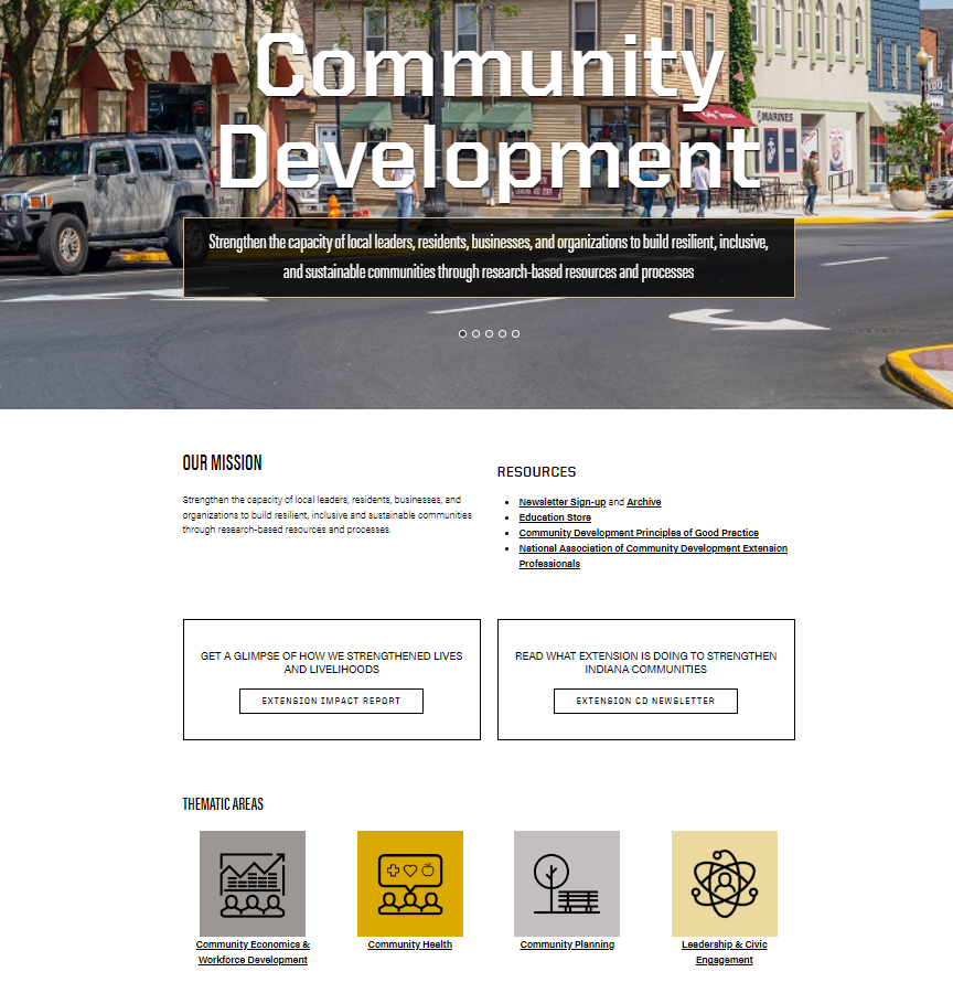
Answer: Purdue Extension has wind energy resources and information through the Purdue Extension – Community Development program. This program strengthens the capacity of local leaders, residents, businesses, and organizations to build resilient, inclusive and sustainable communities through research-based resources and processes. The team actively partners with a variety of state-level entities, including state agencies, private and nonprofit organizations, as well as universities and colleges. Such partnerships have facilitated the launch of applied research projects, the development of innovative educational programs and the delivering of technical assistance and non-formal education programs that are designed to meet the unique needs of Indiana communities and regions.
Under “Community Planning” you will find the resources and information for Renewable Energy. Learn more about the Purdue Extension Land Use Team as you visit the overview and find contacts, events, publications, general renewable energy, solar and wind resources.
Here are just a few of the resources listed on the Community Development-Community Planning-Wind Energy web page:
Agricultural Impact Statements: Wind Farms – State of Wisconsin Department of Agriculture, Trade and Consumer Protection
This article provides construction recommendations for commercial scale wind farms on farmland located specifically in the state of Wisconsin. This resource has links to licenses, permits, impact statements and groundwater quality reports that all pertain to the impacts of wind turbines on green-fields and the surrounding areas.
An Examination of the Community Level Dynamics Related to the Introduction of Wind Energy in Indiana
A team of researchers from Purdue University focused on where wind farm projects have and have not been located and examined socio-economic conditions that have resulted since the wind farms were (or were not) installed and made operational.
Blowing in the Wind: The Answer to Farmland Preservation – University of Michigan
This resource highlights the ways commercial wind farms can be used to preserve farmland and farming communities. This resource also emphasizes that wind farms are another source of income for farmers without having to sell their land.
Does my Land Qualify for a Wind Lease, LandGate Resources
This article highlights the requirements of a proper site for a commercial wind farm. These requirements include acreage, power grid access and the quality of the land. Included is a wind land estimator, designed to provide a rough estimate of a possible wind lease.
Sample Zoning for Wind Energy Systems – Michigan State University Extension
This publication presents a zoning ordinance sample amendment for utility-scale wind energy systems and smaller wind electric generation systems for an individual business or home.
These resources are just a glimpse from the Community Development program which shares many aspects of wind energy, along with other community planning, community economics and workforce development, community health, leadership and civic engagement. If you have further questions, feel free to reach out to the Renewable Energy Team.
Other Resources:
Environmental Planning in Community Plans, The Education Store, Purdue Extension’s resource center
Enhancing the Value of Public Spaces: Creating Healthy Communities, The Education Store
Conservation through Community Leadership, The Education Store
Tree Installation: Process and Practices, The Education Store
Planting Forest Trees and Shrubs in Indiana, The Education Store
Planting Your Tree Part 1: Choosing Your Tree, Video, Purdue Extension – Forestry and Natural Resources YouTube Channel
Tipping Point Planner
Sustainable Communities Extension Program
Subscribe – Purdue Extension – Forestry and Natural Resources YouTube Channel
Purdue Extension-Forestry and Natural Resources Calendar, workshops and Conferences
Michael Wilcox, Program Leader
Purdue Extension Community Development
Kara Salazar, Assistant Program Leader for Community Development and Sustainable Communities Extension Specialist
Purdue Forestry and Natural Resources/Illinois-Indiana Sea Grant/Purdue Extension
Diana Evans, Extension and Web Communication Specialist
Purdue University Department of Forestry and Natural Resources
Kara Salazar has been promoted to Assistant Program Leader for Purdue Extension Community Development. She has served in this role part-time but will now be fully dedicated to this program area. Kara will maintain her 25% appointment with Illinois-Indiana Sea Grant (IISG) and serve on the Agriculture Natural Resources (ANR) Extension Advisory Committee. She will still be located in the Forestry Building (FORS 308) and affiliated with the Department of Forestry and Natural Resources (FNR).
Working with multidisciplinary teams, Kara oversees the development and delivery of programs to support environmental planning, community development, and sustainable development strategies in communities across Indiana and the Great Lakes states. Kara provides leadership to the Purdue Extension Community Development Program and serves as a liaison between Illinois-Indiana Sea Grant and Purdue Extension.
Kara has a B.S. in public affairs and environmental science and a M.P.A. in natural resources management and nonprofit management from the Indiana University School of Public and Environmental Affairs. She also received a M.S. Ed . degree from the IU School of Education at Indiana University-Purdue University Indianapolis (IUPUI) with concentrations in community building and science education. Additionally, she is a Ph.D. candidate in Natural Resources Social Science at Purdue University. Kara is a member of the American Institute of Certified Planners (AICP), a Climate Change Professional (CC-P), and a Professional Community and Economic Developer (PCED) with credentials from LEED AP Neighborhood Development, the National Green Infrastructure Certification Program (NGICP), and the National Charrette institute.
Congratulations to Kara in her new position as she continues to move Purdue Extension and IISG forward with her expertise and team building.
Check out Kara’s lead role in the following programs and learn about the vast resources available:
Purdue Extension Community Development – strengthens the capacity of local leaders, residents, businesses, and organizations to build resilient, inclusive and sustainable communities through research-based resources and processes. Examples of a few of the programs and resources available include: Leadership and Civic Engagement, Community and Organizational Planning, Economic and Business Development.
Illinois-Indiana Sea Grant (IISG) – utilizes research, outreach, and education to bring the latest science to Great Lakes communities and their residents. By connecting decision-makers with science, we help strengthen and preserve ecosystems and communities in southern Lake Michigan and beyond.
Agriculture & Natural Resources (ANR), Purdue Extension – ANR Educators serve as research based, unbiased information source for county and state constituents on a variety of topics including: crops, ag business, livestock, natural resource, horticulture, small farms, urban ag, pesticide use, and land conservation.
Purdue Extension – a leader in providing relevant, high-impact educational programs that transform he lives and livelihoods of individuals and communities in Indiana and the world. Purdue Extension – Forestry & Natural Resources (FNR) is a branch of the Cooperative Extension Service/Purdue Extension. FNR Extension provides resources for aquaculture, fish management, urban and forestry management, natural re source planning, wildlife, and sustainable biomaterials. We encourage you to browse, download free publications, utilize our Ask an Expert, subscribe to Got Nature? newsletter and view upcoming workshops.
Sustainable Communities Extension Program (SCEP) – provides multidisciplinary teams focusing in the following areas: Placemaking and Enhancing the Value of Public Spaces; Land use Planning Education; Green Infra structure; Community Development; American Citizen Planner; Facilitation and Strategic Planning; Conservation Through Community Leadership; Rainscaping Education and Tipping Point Planner.
More Resources including Kara’s publications and videos:
Implementation Examples of Smart Growth Strategies in Indiana, The Education Store, Purdue Extension’s resource center
Conservation Through Community Leadership, The Education Store
Climate Change and Sustainable Development, The Education Store
Climate Change: Are you preparing for it?, The Education Store
Tipping Point Planner, The Education Store
Enhancing the Value of Public Spaces, The Education Store
Enhancing the Value of Public Spaces: Creating Healthy Communities, The Education Store
One Water Approach to Water Resources Management, The Education Store
Rainscaping Education Program, Purdue Extension
Conservation Through Community Leadership, Sustainable Communities Extension Program (SCEP)
Community Planning Playlist, Purdue Extension-Forestry & Natural Resources (FNR) YouTube Channel
Rainscaping and Rain Gardens, Purdue Extension YouTube Channel
Conservation through Community Leadership, Purdue Extension You Tube Channel
Enhancing the Value of Public Spaces Program, Purdue Extension YouTube Channel
Tipping Point Planner, Purdue Agriculture YouTube Channel
Indiana Creek Watershed Project – Keys to Success, Partnerships and People, Purdue Extension You Tube Channel
Subscribe to Purdue Extension – Forestry and Natural Resources YouTube Channel
Diana Evans, Extension and Web Communication Specialist
Purdue University Department of Forestry and Natural Resources
The new USDA-Natural Resources Conservation Service (NRCS) website is designed for farmers, ranchers and forest landowners who use NRCS conservation programs, and our partners who help us deliver the conservation mission.
You will find information that includes:
- Conservation Basics: find soil health, soil science, water, air, plants, animals, land, energy, climate, wildlife habitat and invasive species and pests
- Getting Assistance: find your local service center
- Programs & Initiatives
- Resources
- News & Events
For more than 80 years, NRCS has helped people make investments in their operations and local communities to keep working lands working, boost rural economies, increase the competitiveness of American agriculture, and improve the quality of our air, water, soil, and habitat.
As the USDA’s primary private lands conservation agency, NRCS generates, manages, shares data, technology and standards that enable partners and policymakers to make decisions informed by objective, reliable science.
Resources:
Consumer Horticulture: Collecting Soil Samples for Testing, The Education Store , Purdue Extension resource center
Soil Sampling Guidelines, The Education Store
Soil Testing for Lawns, The Education Store
Certified Soil Testing Laboratories, Purdue Extension – Master Gardener Program
Lawn to Lake Midwest, Illinois-Indiana Sea Grant Program
Forest Improvement Handbook, The Education Store
Frost Seeding Native Grasses and Forbs with a Drone (UAV), Purdue Extension-Forestry & Natural Resources (FNR)
Hardwood Ecosystem Experiment – Wildlife Responses to Timber Harvesting, The Education Store
Invasive Plants: Impact on Environment and People, The Education Store
Sustainable Communities, Purdue Extension
Urban Forestry, Playlist, Purdue Extension – FNR YouTube Channel
USDA-Natural Resources Conservation Service (NRCS)
Photo credit: Adobe Stock
Lawn to Lake Midwest is a great resource as the experts share each month care tips on how to have a healthy lawn all year long while using natural lawn care practices. For the month of May check out the things to watch out for and why testing your soil is important.
You will also find resources for more options for a sustainable lawn:
- Take the Natural Lawn Care Quiz and see where you are at with your lawn care practices.
- Take a look at some simply ways to incorporate more natural lawn care practices.
- If you’re ready, jump into the weeds to explore even more sustainable lawn management practices.
- Find answers to commonly asked lawn care questions.
Resources:
Forest Improvement Handbook, The Education Store
Turfgrass Science, Department of Horticulture & Landscape Architecture
Turfgrass Insect Management, The Education Store
Tree Planting Part 1: Choosing a Tree, Video, The Education Store
Purdue Turf Doctor app for Apple iOS, Apple App Store
Illinois-Indiana Sea Grant (IISG)
 MyDNR Newsletter, Indiana Department of Forestry and Natural Resources: Gov. Eric J. Holcomb and DNR Director Dan Bortner recently announced 38 communities and non-profit organizations will receive a combined $65 million for 77 miles of new trail development.
“Trails connect communities together in such a personal way and are perfect pathways to good mental and physical well-being,” Gov. Holcomb said.
A $150 million grant program, Next Level Trails is the largest infusion of trails funding in state history. In rounds one and two, a total of $55 million was awarded to 35 communities. To date, $120 million has been awarded to build 190 miles of trails throughout Indiana. Ninety-four percent of Hoosiers live within five miles of a trail.
The grants awarded in the third round include 17 regional projects and 21 local projects. The list of awards, project descriptions, and a map are posted at on.IN.gov/NLT-round-3.
To read other news articles visit Indiana Department of forestry and Natural Resources website.
Resources:
Enhancing The Value of Public Spaces, Purdue Extension Forestry and Natural Resources
Enhancing The Value of Public Spaces: Creating Healthy Communities, The Education Store, Purdue Extension’s resource center
Fun Trail Event Days, Indiana Department of Natural Resources
Healthy and Wellness Videos, The Nature of Teaching YouTube Channel
Benefits of Connecting with Nature, The Education Store
Indiana Department of Natural Resources
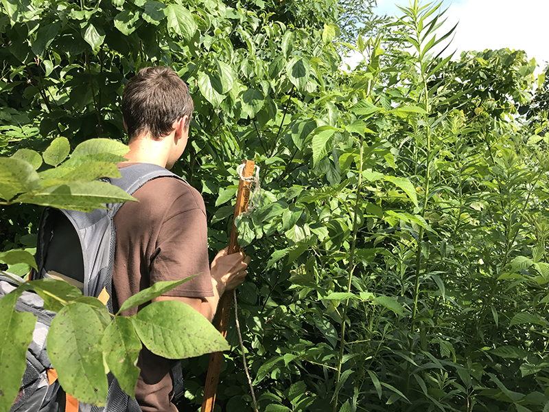
Frost seeding is a great way to establish native grasses and forbs for soil and water conservation and to create habitat for various wildlife and pollinators. You can use multiple tools for frost seeding, such as a tractor or ATV and broadcast spreader or a hand “whirlybird” seed spreader. But one innovative way to broadcast the seed is with a drone – or Unmanned Aerial Vehicle (UAV).
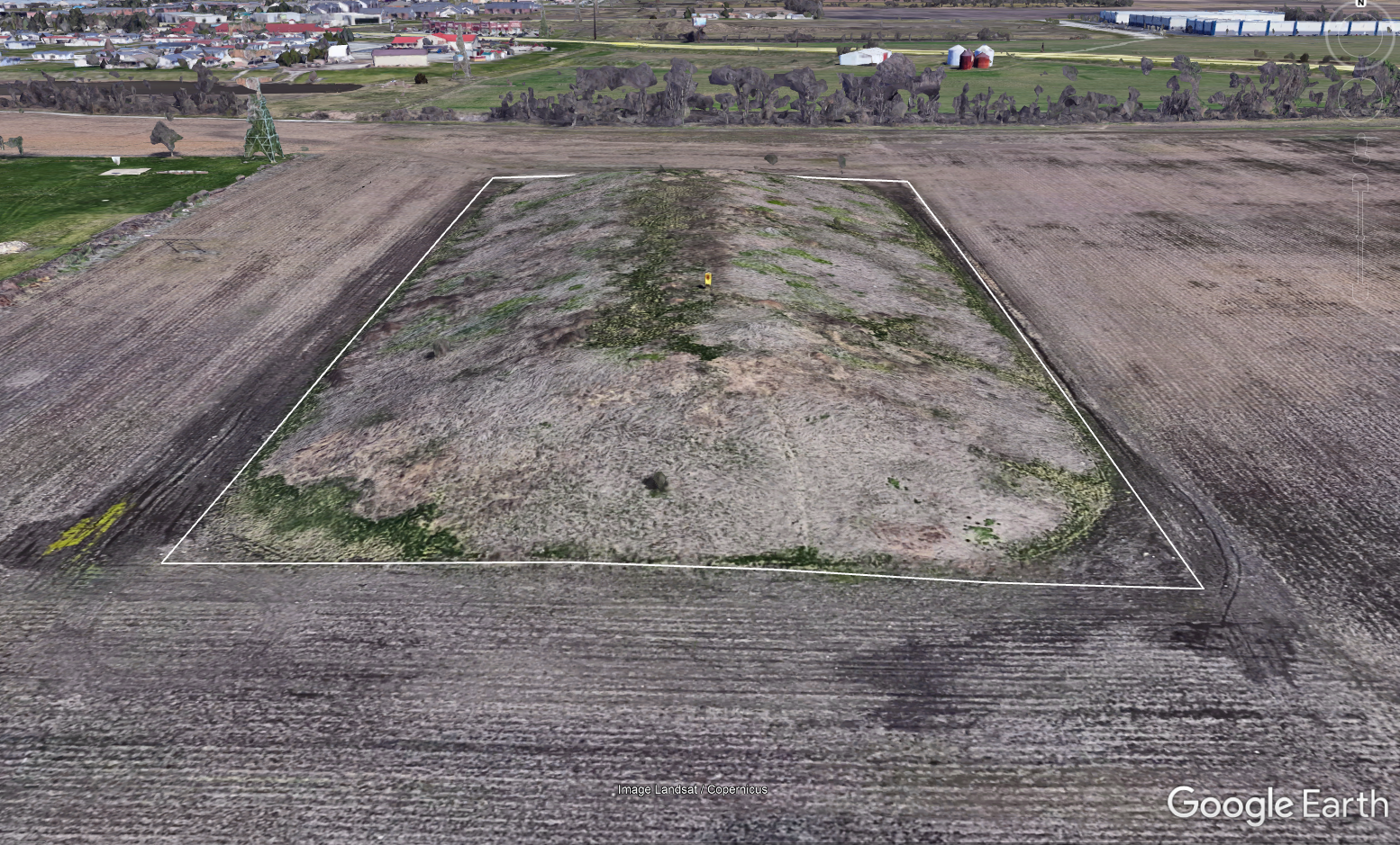
A drone is the tool we used to frost seed native grasses and forbs as part of a project on the Ivy Tech Community College-Lafayette Campus.
The Project
 Faculty and staff within the Agriculture Program at Ivy Tech Community College received a grant from the Wabash River Enhancement Corporation (WREC) to plant native grasses and forbs on their property for educational and demonstration opportunities.
We planted a 4-acre mound created from soil leftover after digging a nearby retention pond. The topography and slopes of the mound made using traditional planting equipment like a tractor and no-till drill a challenge. And since the Ivy Tech staff was already familiar with using drones to plant cover crops, they decided it would be the best option to seed the mound.
The Indiana Natural Resources Conservation Service State Biologist created the seed mix we used. The mix included a diverse blend of native warm-season grasses and forbs.
 Purdue Extension and Purdue Forestry and Natural Resources assisted in the project by supplying, calibrating, and flying the drone, sharing previous experiences with frost seeding native grasses and forbs, and adjusting the seed mix by adding a carrier to improve seed flow through the drone seed spreader.
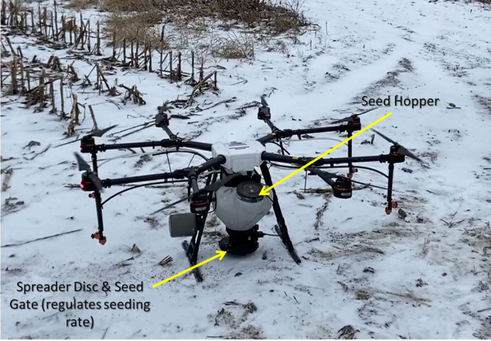
The Drone Set-up
We used a DJI Agras MG-1P drone fitted with a seed hopper that could be filled with up to 22 pounds of seed. Once filled, the drone spreads the seed at a specific rate (pounds per acre) by flying a consistent speed and height across the field along a predetermined path. A hand-held controller allows you to change the drone’s flight path, speed, and height. The controller also allows you to turn the broadcast spreader on or off, adjust the seed gate opening (% open), and the revolutions/minute of the disc to change the rate of the spreader.
The Process
Mixing the seed
The first step was to ensure the seed would flow through the seed hopper. This drone is set up to spread cover crops, which are usually large, heavy seeds like cereal rye or smaller (but still relatively heavy) seeds like clovers.
Native grasses and forbs are often much smaller and lower in weight by volume than cover crops. The grasses are also “fluffy” or have extra seed parts (chaff or awns), making them prone to clogging. These qualities of native grasses and forbs can present a challenge when trying to broadcast them without specialized equipment. We often add a carrier, like pelletized lime, to add more weight to the seed mix and allow the seed to flow more easily through the spreader. We added 40 pounds of pelletized lime per acre to the seed mix.
Calibrating the drone
We needed to calibrate the drone to spread the right amount of seed per acre. Calibrating a drone is similar to calibrating any broadcasting equipment. We needed to know:
- How wide the spreader spreads the seed (swath width)
- How fast the drone is flying
- How much seed (lbs) is being spread over a specific area
Check out this video for more information about frost seeding and calibrating a broadcast spreader.
Creating the map and programming the drone
After finishing the calibration, we went to the field to create the map for the project and program the drone. The initial step with the drone is to create a boundary layer in the mapping software. We did this by physically taking the controller to the four corners of the mound and setting a GPS point. When the accuracy showed 5 feet or less, we dropped a pin and used that as a corner. Once the corners were marked, the mapping software created the boundaries of the mound and created an automated path for the drone to fly.
Once we completed the map, we filled the drone with seed and set the flight parameters. Our calibration figures showed that we needed a 90% hopper opening with a speed of 2 mph, and we had a swath width of 18 feet from 10 feet above the ground (drone height). The disc speed was set to 900 revolutions per minute.
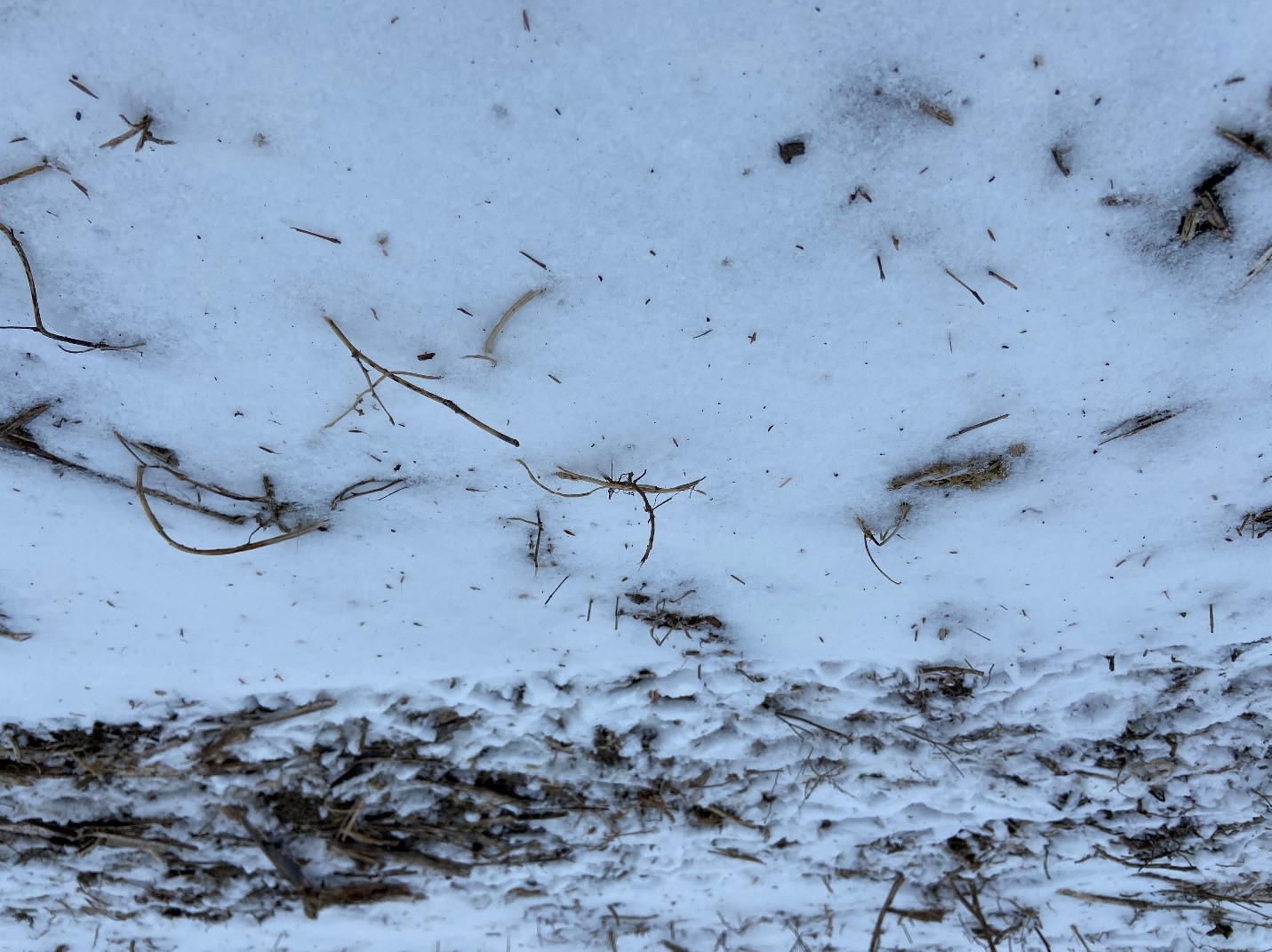
Spreading the Seed
Once the seed was mixed and the drone was calibrated and programmed, we started spreading the seed. With the drone, this is as easy as filling the seed hopper, starting the drone, and allowing it to fly the planned and automated mission. Once the seed hopper is empty, the drone automatically remembers where it stopped and returns home to be refilled. Once refilled, the drone will return to where it stopped and restarts spreading the seed. This process repeats until the drone has covered the entire field.
The Challenges
Fluffy seeds and seed flow
One of the biggest challenges we encountered was the flow of the native grass seed through the seed hopper. The seed was too fluffy (not enough weight per volume) to flow correctly through the seed hopper. The seed would flow and spread correctly for a few minutes, then the seed would get clogged, and the drone would stop. Because the fluffy seed was getting stuck at the top of the hopper and not flowing correctly, the sensor on the drone’s seed hopper was telling us the seed hopper was empty. However, at least 5-10 pounds of seed was still in the hopper. This would cause the drone to fly back to be refilled. Each time this happened, it cost us time and battery life on the drone.
We were able to free the seed in the hopper and get it to flow correctly by rocking the drone or flying the drone back and forth quickly until the seed worked itself loose. If you were using traditional equipment like a tractor and fertilizer spreader, the bouncing of the tractor over rough terrain would have naturally agitated the seed and allowed it to flow. But, with a drone flying in the air, the seed was not agitated. We would have needed to add more carrier to the seed mix to increase its weight and improve the seed flow.
Broadcast spreaders designed to spread fluffy seeds like native grasses often have an agitator in the hopper to stop the seed from clogging and improve seed flow. The native grass seed would have flowed better through a drone seed spreader explicitly designed for this type of seed, like this aerial spreader.
Batteries and Battery Life
Some of the challenges with drones, in general, are batteries and battery life. We had to change batteries frequently while spreading and recharge the batteries not in use to ensure we had enough battery life to complete the seeding. The challenges we had with the seed flow exacerbated our challenges with batteries because each time we had to check the seed hopper or free the seed, it cost us battery life.
It was helpful that we had six batteries. This allowed us to rotate between using batteries and charging them and meant we didn’t have to stop spreading to wait on batteries to be charged.
Flight speed
Because we added extra weight to the seed mix by using a carrier, we needed to fly the drone at a slow speed to spread at the correct rate per acre. Keeping the drone at a lower speed (2 mph) was challenging. Often the drone flew at around 3 mph. This is likely due to the physical properties of the electric motors turning the propellers to keep the drone aloft.
Drone malfunction
Another challenge we faced was a malfunction on the UAV where the spreader gate was opening and closing on its own, or not opening at all, and had an error showing on the controller screen that the gate was blocked. We noticed this error and worked on the UAV during the calibration phase and thought it was repaired. We had to stop and take the spreader apart again to identify the problem.
On the day we seeded, we finally decided to open the hopper to 90% opening and physically stop the gears from opening and closing. This left the hopper open constantly, but we could still turn the spreader on and off. After finishing the seeding, we determined the issue was either a faulty servo motor or control board. These parts are inexpensive and can be replaced, but they are specialized parts that require ordering and cannot be picked up from a local hardware store.
Cost of the drone
 The DJI Agras MG-1P is an older model (older, not outdated), so the cost has decreased. Initially this model cost around $19,000, but it is now about $8,000. This includes both attachments for spraying and spreading. Additional batteries are around $700 each. Cost for the newer models of this type of drone range from $18,000 to ~$30,000, depending on the size and payload.
The Results
Despite the challenges we faced, the drone worked well for spreading the native grass and forb seed for this project. We applied the correct amount of seed required for the area. When the seed flowed correctly, it was spread evenly on the site. However, we will need to come back to the site during the next few summers to see how well native grasses and forbs are established.
A drone may not be effective for large-scale conservation plantings because of the time and batteries required, the small hopper size, and the need to refill the seed hopper. But for smaller plantings or those plantings in areas inaccessible by traditional equipment (in wetlands, on steep slopes, woodlands, etc.), drones could be an effective tool to establish native grasses and forbs.
Resources:
Frost Seeding to Establish Wildlife Food Plots & Native Grass and Forb Plantings, video, The Education Store, Purdue Extension Resource Center
Calibrating a No-Till Drill for Conservation Plantings and Wildlife Food Plots, video, The Education Store
Renovating native warm-season grass stands for wildlife: a land manager’s guide, The Education Store
Creating a Wildlife Habitat Management Plan for Landowners, The Education Store
Purdue Extension Pond and Wildlife Management Website, Purdue Extension
Jarred Brooke, Wildlife Extension Specialist
Purdue Forestry and Natural Resources
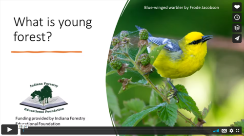
 What do whip-poor-wills, woodcock, bobcats, and box turtles have in common? All these species make their home in young forests. But, what is a young forest? And what do young forests look like?
This new video series from the Hoosier National Forest helps shed some light on these questions and more.
Specialists representing a diversity of organizations (American Bird Conservancy, Purdue Extension, National Wild Turkey Federation, Indiana Department of Natural Resources, U.S. Forest Service) discuss the importance of young forest as habitat for a wide variety of wildlife, managing young forests and misconceptions about young forest.
 U.S. Forest Service Vimeo Young Forest Videos:
- Hoosier National Forest – What is young forest?
- Who Needs Young Forest?
- What Does Young Forest Management Look Like?
- Misconceptions About Young Forest
Other resources:
Harvesting our forests, the wildlife debate, Purdue Extension – Forestry and Natural Resources (FNR) Got Nature? Blog
Wildlife Responses to Timber Harvesting, The Education Store, Purdue Extension’s resource center
Breeding Birds and Forest Management: the Hardwood Ecosystem Experiment and the Central Hardwoods Region, The Education Store
 Forest Management for Reptiles and Amphibians: A Technical Guide for the Midwest, The Education Store
Hardwood Ecosystem Experiment – Forest Birds , Purdue Extension – FNR YouTube Channel
Managing Woodlands for Birds , Purdue Extension – FNR YouTube Channel
Sustaining Our Oak-Hickory Forests , Purdue Extension – FNR YouTube Channel
Ask the Expert: Hardwood Ecosystem Experiment – Birds and Salamander Research, Purdue Extension – FNR YouTube Channel
Hardwood Ecosystem Experiment Highlights: Breeding Birds, Purdue Extension – FNR YouTube Channel
Hardwood Ecosystem Experiment Highlights: Small Mammals, Purdue Extension – FNR YouTube Channel
Hardwood Ecosystem Experiment Highlights: Salamanders, Purdue Extension – FNR YouTube Channel
Hardwood Ecosystem Experiment Highlights: Moths, Purdue Extension – FNR YouTube Channel
Hardwood Ecosystem Experiment Highlights: Bats, Purdue Extension – FNR YouTube Channel
Hardwood Ecosystem Experiment: How the HEE Came to Be, Purdue Extension – FNR YouTube Channel
Hardwood Ecosystem Experiment publications , Hardwood Ecosystem Experiment (HEE) website
New Videos Stress Importance of Young Forests, Purdue News – Forestry and Natural Resources
Jarred Brooke, Wildlife Extension Specialist
Purdue Forestry and Natural Resources
In this episode of A Woodland Management Moment, Purdue Extension forester Lenny Farlee talks about crop tree release, the process of selecting timber crop trees that help meet your management objectives and managing the area around them in order to allow your selected trees to thrive in the stand.
If you have any questions regarding trees, forests, wildlife, wood products or other natural resource topics, feel free to contact us by using our Ask an Expert web page.
Resources:
A Woodland Management Moment, Playlist, Purdue Extension – Forestry and Natural Resources (FNR) YouTube Channel
Shrubs and Woody Vines of Indiana and the Midwest, Purdue University Press
Native Trees of the Midwest, Purdue University Press
ID That Tree, Playlist, Purdue Extension – FNR YouTube Channel
Investing in Indiana Woodlands, The Education Store
Woodland Stewardship for Landowners Video Series, Playlist, Indiana Department of Natural Resources YouTube Channel
Ask an Expert: Tree Selection and Planting, Purdue Extension – Forestry and Natural Resources (FNR) YouTube Channel
Lenny Farlee, Sustaining Hardwood Extension Specialist
Purdue University Department of Forestry and Natural Resources
 Purdue Extension: Purdue Extension is your educational partner for life. The 2020 Impact Report shows how Extension delivers practical, research-based information and events for Indiana’s residents in agriculture and natural resources, health and human sciences, and community development, and trains tomorrow’s leaders through Indiana 4-H Youth Development.
Check out the Purdue Extension-Forestry & Natural Resource highlights on the following programs and extension specialists:
- Keeping our forests healthy, pg. 5. Program: Forest Management for the Private Woodland Owner taught by Ron Rathfon, Purdue Extension Forester at the Southern Indiana Purdue Agricultural Center. For the northern counties Lenny Farlee, sustaining hardwood extension specialist with Purdue Forestry and Natural Resources, teaches the Management for the Private Woodland Owner Course.
- A comprehensive approach to community development, pg. 43. Program: Enhancing the Value of Public Spaces, Kara Salazar, program leader and extension specialist for sustainable communities, and Dan Walker, community planning extension specialist, both with Purdue Forestry and Natural Resources.
- Actively managing natural resources, pg. 52. Programs in partnership with Illinois-Indiana Sea Grant (IISG): Tipping Point Planner, Conservation Through Community Leadership and Sustainable Communities, Kara Salazar, program leader and extension specialist for sustainable communities.
Resources
Woodland Stewardship for Landowners, Playlist, Purdue Extension – Forestry and Natural Resources YouTube channel
A Woodland Management Moment, FNR – Ext Playlist
Hardwood Ecosystem Experiment – Wildlife Responses to Timber Harvesting, The Education Store, Purdue Extension resource center
Forest Improvement Handbook, The Education Store
Community Planning, FNR -Ext Playlist
Enhancing the Value of Public Spaces: Creating Healthy Communities, The Education Store
Community Planning for Agriculture and Natural Resources: A Guide for Local Government, The Education Store
Tipping Point Planner, Website
Tipping Point Planner, The Education Store
Ron Rathfon, Regional Extension Forester
Purdue Department of Forestry and Natural Resources
Lenny Farlee, Sustaining Hardwood Extension Specialist
Purdue Department of Forestry and Natural Resources
Kara Salazar, Assistant Program Leader and Extension Specialist for Sustainable Communities
Purdue Department of Forestry and Natural Resources
Dan Walker, Community Planning Extension Specialist
Purdue Department of Forestry and Natural Resources
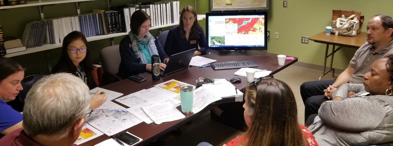 The Tipping Point Planner project, a joint effort by Illinois-Indiana Sea Grant and Purdue Extension, has been selected as a 2020 recipient of the Purdue College of Agriculture’s TEAM (Together Everyone Achieves More) Award.
“The TPP program stands out because of its value and impact in assisting local communities in the Great Lakes Region,” Purdue Forestry and Natural Resources department chair Bob Wagner said in his nomination. “The program is unique in that it is composed of community activities dovetailed with a decision support system (DSS) that is based on user needs assessment. The TPP program has been in existence for nearly 10 years and has demonstrated outstanding innovation and impact. As an example, Esri recently showcased TPP as a model system that uses Esri technology to assist communities in important ways. This program highlights the success that both research and extension efforts can have when working closely together.”
The program was also recognized for its accomplishments in the Sustainable Use and Stewardship of Ocean and Coastal Resources segment of the National Oceanic and Atmospheric Administration’s 2019 Science Report, released in March.
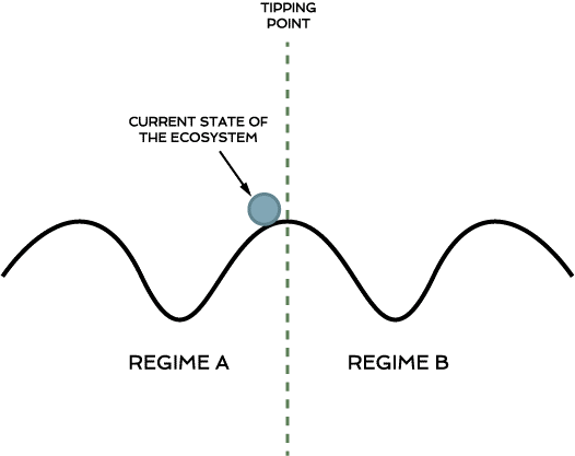
The Tipping Point Planner was created to assist community leaders throughout the Great Lakes Basin in making long-term management decisions that affect environmental health of local resources and a community’s quality of life. The program, which includes a web-based decision support system, helps identify the status of watershed health by exploring land use, natural resources and environmental concerns, before determining the impacts of land-use decisions and management practices and, in turn, enables communities keep coastal ecosystems from reaching critical environmental limits, or tipping points, and becoming unstable.
 In 2019, the Tipping Point Planner team worked with communities in Au Gres, Michigan; and Perrysburg, Ohio, to create action plans regarding conservation and ecological resource management. All told, more than 100 people in these areas utilized the Tipping Point Planner and collaborated in making the community decisions.
The science supporting TPP stems from multidisciplinary, collaborative work across several Big Ten universities and their associated Sea Grant and Extension offices. Lead researchers came from Purdue University, the University of Michigan, Michigan State University, the University of Illinois-Chicago, the University of Minnesota-Duluth, and NOAA’s Great Lakes Environmental Research Laboratory.
Team members secured more than $14 million in extramural funding from the National Science Foundation (NSF), Great Lakes Fishery Trust, EPA’s Science to Achieve Results Program, National Aeronautics and Space Administration (NASA), United States Geological Survey (USGS) Climate Change Program, Wege Foundation, and the Kellogg Foundation to enable the necessary data collection, modeling, survey work, and stakeholder interviews. The project also was funded as part of Purdue University Department of Forestry and Natural Resources’ (FNR) Signature Areas (2005-2011), which supported five FNR students working on various aspects of the project.
 Dr. Bryan Pijanowski, professor of landscape and soundscape ecology; Kara Salazar, assistant program leader and extension specialist for sustainable communities; Lydia Utley, data analyst; and Daniel Walker, community planning extension specialist, are the project leaders for the Tipping Point Planner.
The project also includes representatives from Purdue Agricultural and Biological Engineering, NOAA Great Lakes Environmental Research Laboratory and the Michigan State University Hydrogeology Lab. Other collaborators include the Eureka Aquatic Research, LLC; Michigan State University Center for Water Sciences, Michigan State College of Agriculture and Natural Resources, Michigan School for the Environment and Sustainability, the University of Albany College of Engineering and Applied Sciences, the University of Minnesota Duluth Natural Resource Research Institute and the U.S. Geological Survey Great Lakes Science Center.
The full Tipping Point Planner Team consists of:
NOAA Great Lakes Environmental Research Laboratory
- Dr. Edward Rutherford – Research Fishery Biologist
Purdue University Human-Environment Modeling & Analysis Laboratory
- Dr. Bryan Pijanowski – Professor
- Dr. Kristen Bellisario – Post-Doctoral Research Associate
- Dr. Kimberly Robinson – Former Graduate Student
- NahNah Kim, JD – Former Graduate Student
Purdue University Agricultural & Biological Engineering
- Dr. Bernard Engel – Professor and Department Head
- Dr. Larry Theller – Research Associate (Retired)
- Dr. Yaoze Liu – Postdoctoral Research Assistant
- Dr. Jingqiu Chen – Postdoctoral Research Associate
Michigan State University Hydrogeology Lab
- Dr. David Hyndman – Professor and Department Chair
- Dr. Anthony Kendall – Research Assistant Professor
- Dr. Sherry Martin – Research Associate
- Emily Luscz – Former Graduate Student
- Quercus Hamlin – Graduate Student
- Luwen Wan – Graduate Student
Michigan State University Center for Water Sciences
- Dr. R. Jan Stevenson – Professor and Co-Director of CWS
Michigan School for Environment and Sustainability
- Dr. Mike Wiley – Professor (Retired)
- Dr. Catherine Riseng – Professor
Eureka Aquatic Research LLC
- Dr. Hongyan Zhang – Aquatic Ecologist
USGS Great Lakes Science Center
- Dr. Yu-Chun Kao – Research Associate
University of Minnesota Duluth Natural Resource Research Institute
- Dr. Lucinda Johnson –Associate Director for Water
Illinois-Indiana Sea Grant
- Dr. Brian Miller – Director (Retired) and Project Manager
- Kara Salazar – Assistant Program Leader and Extension Specialist for Sustainable Communities
- Dan Walker – Community Planning Extension Specialist
- Lydia Utley – Data Analyst
- Ben Wegleitner – Former Outreach Assistant
Resources
Tipping Point Planner
Illinois-Indiana Sea Grant Tipping Point Planner
With GIS, Communities See How Land-Use Changes May Affect Local Water Quality
Tipping Point Planner curriculum available from Purdue Extension Education Store
Tipping Point Planner Online course
Tipping Points: What are they? Why are they important?
Tipping Point Planner
Kara Salazar, Assistant Program Leader for Community Development and Sustainable Communities Extension Specialist
Purdue Department of Forestry and Natural Resources/Illinois-Indiana Sea Grant
Recent Posts
- Purdue Extension 2024 Impact Report
Posted: January 16, 2025 in Forestry, Land Use, Plants, Publication, Wildlife, Woodlands - Hardwood Tree Improvement Regeneration Center (HTIRC) Shares Fall Newsletter, Research and Outreach
Posted: December 13, 2024 in Forestry, Land Use, Natural Resource Planning, Woodlands - Purdue Extension’s Showcase, Impacting Indiana
Posted: November 8, 2024 in Community Development, Forestry, Forests and Street Trees, Gardening, Land Use, Natural Resource Planning, Timber Marketing, Urban Forestry, Wildlife, Wood Products/Manufacturing, Woodlands - American Citizen Planner – Indiana Program Celebrating 4 Years of Impact
Posted: October 16, 2024 in Community Development, Land Use - Publication – Quality of Place and Community Development
Posted: July 18, 2024 in Community Development, Land Use, Publication, Urban Forestry - Publication – Introduction to White-tailed Deer Impacts on Indiana Woodlands
Posted: April 28, 2024 in Forestry, Land Use, Plants, Publication, Wildlife, Woodlands - Publication – Understanding White-tailed Deer and Their Impact on Indiana Woodlands
Posted: in Forestry, Land Use, Plants, Publication, Wildlife, Woodlands - Publication – Monitoring White-tailed Deer and Their Impact on Indiana Woodlands
Posted: in Forestry, Land Use, Plants, Publication, Wildlife, Woodlands - Publication – Managing White-tailed Deer Impacts on Indiana Woodlands
Posted: in Forestry, Land Use, Plants, Publication, Wildlife, Woodlands - New Deer Impact Toolbox
Posted: April 7, 2024 in Forestry, Land Use, Plants, Publication, Safety, Wildlife, Woodlands
Archives
Categories
- Alert
- Aquaculture/Fish
- Aquatic/Aquaculture Resources
- Ask the Expert
- Christmas Trees
- Community Development
- Disease
- Drought
- Forestry
- Forests and Street Trees
- Gardening
- Got Nature for Kids
- Great Lakes
- How To
- Invasive Animal Species
- Invasive Insects
- Invasive Plant Species
- Land Use
- Natural Resource Planning
- Nature of Teaching
- Plants
- Podcasts
- Ponds
- Publication
- Safety
- Spiders
- Timber Marketing
- Uncategorized
- Urban Forestry
- Webinar
- Wildlife
- Wood Products/Manufacturing
- Woodland Management Moment
- Woodlands